Bali Airport Drone Safety Standards: 2027 Outlook
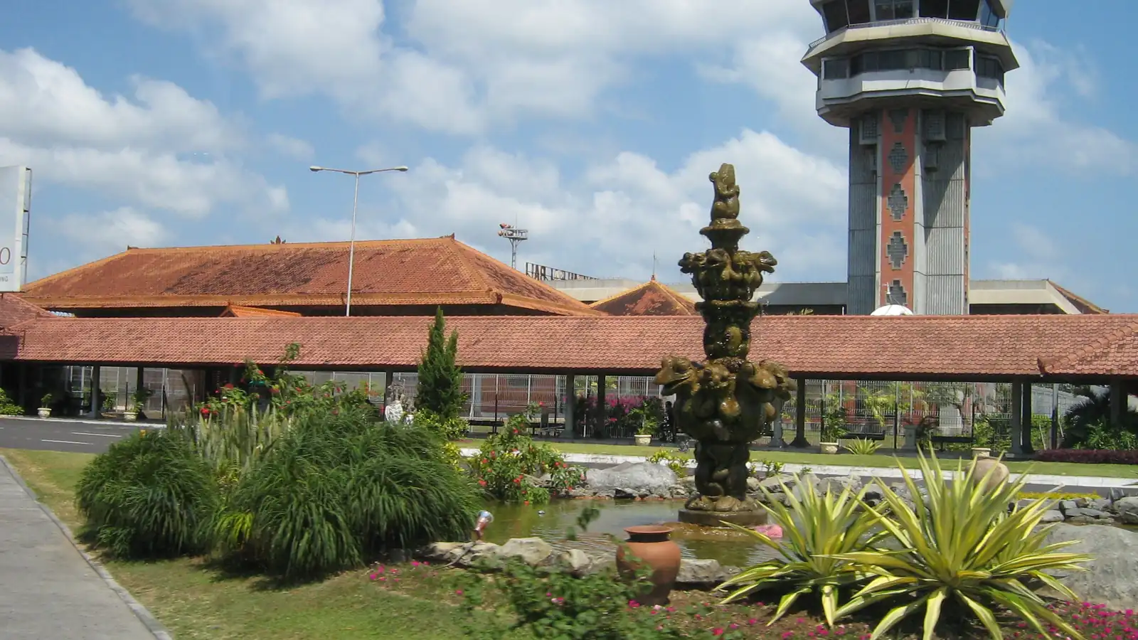
By 2027, Bali airport drone safety standards are expected to tighten around a practical 9–15 km risk radius from Ngurah Rai, with mandatory centralised permits, stricter KKOP approvals, and likely Remote ID plus e-signature documentation. Drone flights near Kuta, Legian, Seminyak and Nusa Dua will almost always need advance written clearances.
How are Ngurah Rai airport drone rules likely to change by 2027?
The current baseline comes from national rules such as PM 90/2015, PM 37/2020 and UU No. 1/2009, which already prohibit unsafe activity in the KKOP (Kawasan Keselamatan Operasi Penerbangan) around any airport without written approval. For Ngurah Rai, several 2026 guides describe a practical 15 km airport zone that operators are told to avoid, even though the legal KKOP geometry is defined per-airport.
By 2027, regulators are expected to re‑emphasise a stepped model: a hard no‑fly core that matches controlled airspace near the runway, a 9 km radius Ngurah Rai drone safety buffer for most hobby flights, and a wider professional operations ring that is only possible with Directorate General of Civil Aviation (DGCA) permission. PM 37/2020 already requires DGCA approval for drone operations in KKOP and controlled airspace, so the likely change is stricter enforcement rather than brand‑new concepts.
For buyers, this means any professional filming, survey or event work in Kuta, Jimbaran, Legian, Seminyak, Nusa Dua or Sanur should be treated as an “airport project” from the start. Expect more questions about aircraft type, maximum altitude, and exact coordinates, and be prepared for detailed safety documentation, especially if the take‑off point or subject lies within a 9 km radius of Ngurah Rai.
What does the 9 km radius Ngurah Rai drone safety buffer mean for filming locations?
Older controlled‑airspace references mention a 5 NM (about 9.26 km) protection radius from major airports for low‑level aviation traffic. In practice, many 2026 Bali drone advisories translate this into a working “do not fly without explicit permission” circle. Inside that distance, drone operations intersect approach and departure paths more frequently, especially below 400 ft.
By 2027, this 9 km safety buffer is likely to sit inside a broader 15 km advisory zone around Ngurah Rai that already covers much of South Bali tourism. Locations such as central Kuta, parts of Legian Beach, Tuban and southern Seminyak are either within the 9 km ring or borderline. A drone filming permit near Ngurah Rai for these places will probably require a more formal risk assessment, coordinated airspace clearance through AirNav Indonesia, and possibly limited time windows to avoid peak traffic.
Areas closer to or beyond the 15 km edge (for example Canggu, Tanah Lot or Ubud) may still be constrained by other restricted or controlled airspace segments but are less likely to trigger full airport‑zone treatment. The overall bali airport drone safety standards 2027 outlook suggests more precise GPS‑based mapping and automated rejection of casual flight plans that cross into the inner protection ring.
How might technology and DJI GEO affect airport‑zone drone work by 2027?
Consumer systems already rely on geofencing, and platforms such as DJI GEO flag Ngurah Rai’s controlled airspace as a restricted or warning zone. In 2026, many pilots use DJI GEO unlock for Ngurah Rai airport on a case‑by‑case basis, uploading proof of permit before the aircraft will arm. By 2027, this workflow is expected to become more robust and less negotiable.
Globally, regulators are moving toward electronic identity and airspace authorisation. Indonesia is widely expected to introduce possible Remote ID requirements by 2027, at least for professional operations. Remote ID would broadcast the drone’s identity and position to authorities, allowing quick verification of whether a flight in the KKOP is covered by a permit. Integration between Remote ID and manufacturer geofencing would make “off‑grid” flights much harder near airports.
For production companies, this means that a paper permit might no longer be enough. Authorities may request that operator IDs, permit references and flight plans be pre‑registered in national or airport‑level systems that talk to Remote ID receivers. Independent civilian service companies like Drone Permit Bali will still handle coordination only via written channels such as DGCA, DKPPU, AirNav and the SMS‑FSC system, but the technical steps on the client side (account setup, firmware, app logins) could become part of the standard checklist.
What new documentation and contracts should producers expect for Bali airport projects?
As the airspace around Ngurah Rai becomes more regulated, paperwork for any drone permit for Legian Beach, Kuta area rooftops, or coastal hotel flyovers is likely to expand. Existing rules already require written DGCA permissions for KKOP operations and 14 working days’ lead time for many applications. Complex KKOP work today may take 30–45 days, especially for drone shows where NOTAMs and formal risk studies are mandatory.
By 2027, producers should expect more structured contracts and digital records. E signature for drone permit contracts Bali is increasingly common, allowing clients outside Indonesia to legally execute agreements and accept drone permit Bali terms and conditions without wet ink. These contracts will often specify maximum altitude, flight windows, aircraft type and emergency procedures, mirroring the operational limitations in the official approvals.
Content‑side compliance may also grow. For example, music licensing for drone videos shot in Bali can already impact where and how footage is distributed. As more projects blend aerial shots of Ngurah Rai approaches, coastal resorts and events into commercial campaigns, rights‑holders and platforms may demand clear documentation that both airspace and soundtrack are properly licensed. While this is separate from aviation safety law, it increasingly travels together with the permit file.
How will costs, tax and local sponsorship evolve for KKOP‑adjacent drone work?
Fees around Ngurah Rai are usually quote‑based and depend on complexity, lead time, and how deeply the operation penetrates the airport’s KKOP. As of August 2026, coordinators often differentiate between projects completely outside airport‑related zones and those requiring DGCA, AirNav, airport authority and SMS‑FSC involvement. By 2027, this gap is likely to widen.
Clients frequently ask: berapa biaya tambahan kalau lokasi dekat airport zone? Costs can increase significantly if the location requires full Flight Security Clearance, detailed SORA‑style risk analysis, or on‑site safety officers. For larger events and drone shows in Bali, indicative production budgets as of August 2026 range from about Rp277–375 million for 100 drones to around Rp832 million for 300 drones, with the airport‑related permit chain handled end‑to‑end.
For corporate clients and agencies, tax deductible drone permit costs Bali are an important planning element. Many treat permit and consultancy fees as part of production expenses, subject to local tax rules and proper invoicing. In some cases, foreign brands also ask berapa biaya sponsor lokal untuk izin drone bali? because partnering with a local brand or institution can be a strategic, non‑regulatory way to structure payments and visibility. These arrangements do not replace official approvals but can sit alongside them in the commercial plan.
What about hotel interiors and tourism content near the airport by 2027?
Hotel and resort content is expected to grow, and many properties sit under or near Ngurah Rai flight paths. A drone permit for hotel interior flythrough Bali will typically focus on indoor safety and guest privacy, but regulators may also check that take‑off, landing and any exterior transitions stay outside critical KKOP volumes or are covered by permissions.
Hotel management is becoming more sensitive to guest drones as well. Operators planning campaigns that mix interior flythroughs with nearby beach or rooftop exteriors should watch emerging policies on how bali hotels will handle guest drone use by 2027. By 2027, some hotels may require guests and crews to show permit evidence before flying, especially within the broader Ngurah Rai influence area, to avoid conflicts with national law.
Tourism boards and destination marketers are increasingly planning around 2027 trends in drone filming for bali tourism. Airport‑adjacent districts like Kuta and Tuban may see more structured “approved corridors” where professional crews can fly at defined times under strict altitude caps. This kind of zoning would sit on top of the national KKOP framework and is expected to be coordinated through airport and local government channels.
- Typical permit lead time: 14 working days for standard operations; 30–45 days for complex KKOP and drone show venues (as of August 2026).
- Written approvals are coordinated via DGCA/DKPPU, AirNav Indonesia, airport authority and SMS‑FSC for Flight Security Clearance.
- A practical 9 km radius Ngurah Rai drone safety buffer is emerging inside a wider ~15 km advisory zone used in 2026 guidance.
- Remote ID and strengthened geofencing are likely prerequisites for most professional flights near Ngurah Rai by 2027.
- Contracts increasingly use e‑signatures and specify altitude limits, time windows, and exact coordinates for each flight.
- Drone shows budgets in Bali range from about Rp277–375 million for 100 drones to around Rp832 million for 300 drones (as of August 2026).
- Professional filming in Kuta, Legian, Seminyak or Nusa Dua should be treated as airport‑zone work with added compliance steps.
Frequently asked questions
how far from ngurah rai can i fly a drone
For casual flying, many 2026 advisories suggest staying at least 9–15 km away from Ngurah Rai, because that area overlaps controlled airspace and KKOP. Professional operations closer in are only legal with written DGCA and airport approvals. By 2027, enforcement of this radius is expected to tighten, especially for commercial work.
berapa biaya izin drone dekat bandara ngurah rai?
Fees are quote‑based and depend on altitude, risk level, and whether the flight needs DGCA, AirNav and airport authority approvals. As of August 2026, clients should budget at least several million rupiah for basic coordination, with higher ranges for multi‑day shoots or events. Costs may rise by 2027 as requirements and technical checks increase.
berapa biaya tambahan kalau lokasi dekat airport zone?
Additional costs near the airport zone usually reflect extra risk assessment, coordination calls, and Flight Security Clearance via SMS‑FSC. As of August 2026, the “airport uplift” can range from a modest percentage for borderline areas to a substantial premium for operations clearly inside KKOP. Each project is priced individually based on complexity.
berapa biaya sponsor lokal untuk izin drone bali?
Local sponsorship is a commercial arrangement, not a regulatory shortcut. Budgets vary widely, from modest branding contributions for small shoots up to significant co‑marketing spends for large campaigns. As of August 2026, there is no fixed rate; discussions usually align with media value, locations, and the scale of the drone activity being sponsored.
How do I get clearance for a drone filming permit near Ngurah Rai by 2027?
Expect a structured process: clear coordinates, flight profiles, and aircraft details; written submissions to DGCA/DKPPU and AirNav; and, for KKOP or complex sites, FSC via SMS‑FSC. Reviewing the 2027 guide to filming near bali airport with drones and then engaging a specialist for a bali drone permit for events is the safest route.
To scope a 2027‑ready permit and safety plan near Ngurah Rai or other Bali locations, contact the BD desk at Juara Holding Group via WhatsApp 6281139414563 or email bd@juaraholding.com.
Last updated 4 August 2026
Keep Reading
Airspace & Zones
2027 Guide To Drone Filming Near Bali Airport
Filming near Bali’s Ngurah Rai Airport in 2027 is only lawful with a multi-agency permit chain and a precise safety…
Airspace & Zones
U-Space And Drone Traffic Management Over Bali 2027
By 2027, U‑Space style drone traffic management over Bali will likely mean that most professional flights in South Bali are…
Airspace & Zones
The Future Of KKOP Drone Operations In Bali 2027
By 2027, Bali’s KKOP airport safety corridors are expected to be enforced as a hard 15 km no‑fly ring around…